While in Hawaii with my family this summer I had the opportunity to do a 2-night solo backpacking adventure on Kilauea. Even though I couldn’t bring my kids on this part of the hike1It was a bit too technical for them, especially given the remote nature of the campsite and limited water availability. Definitely the next hike, though. it was still a blast.
I set out on a Thursday and drove from our borrowed condo to the National Park. Before actually entering, I snagged a campsite at Nāmakanipaio Campground down the road. My goal was to check in with the Backcountry Office, hit up the temporary visitor center in Kilauea Military Camp, then dine at the Volcano House overlooking the caldera for the evening. My actual hike would start just before sunrise the next morning so I could beat the heat.
Dinner at the summit was worth it. The active eruption itself was paused – but seeing the glow from the vents (with occasional flames) was definitely a highlight.

The Actual Hike
My plan was to hike the Keauhou Trail – starting at the Chain of Craters Road and descending nearly 3000 feet to the coast over a 7 mile rocky hike. I was warned on the outset that it was a challenging hike.
It absolutely was!
Parking on the road was easy – only two other cars there. Then it was about a mile of gradual descent over a newer (circa 1970s) lava flow before turning to hike across an older (1800s) flow with low scrub a scraggly trees. This gave way to the Ka‘ū Desert Wilderness and expansive (yet still volcanic) grasslands as I made my way down the pali to the coast.


I’ve climbed both the South Sister (Oregon) and Mount Saint Helens (Washington) in the past. This descent was eerily familiar – long stretches of volcanic basalt broken up by gravel and sand and scree. I’ve done hikes exactly like this dozens of times so I came prepared with my trekking poles, and my knees were all the more thankful for the help.
Arrival
I was somewhat foolish trying to beat the heat on the descent, so I didn’t bother to stop at all for rest breaks. I did drink water from my Camelbak on the way down but not nearly enough and didn’t really stop for food either. When I reached the three-walled Keauhou shelter just short of the beach, I was exhausted.

I dropped my pack, drank some water, ate some food … then took a long nap in the shelter. After I felt a bit more refreshed it was time to trek the final quarter mile to the coastline.


Keauhou
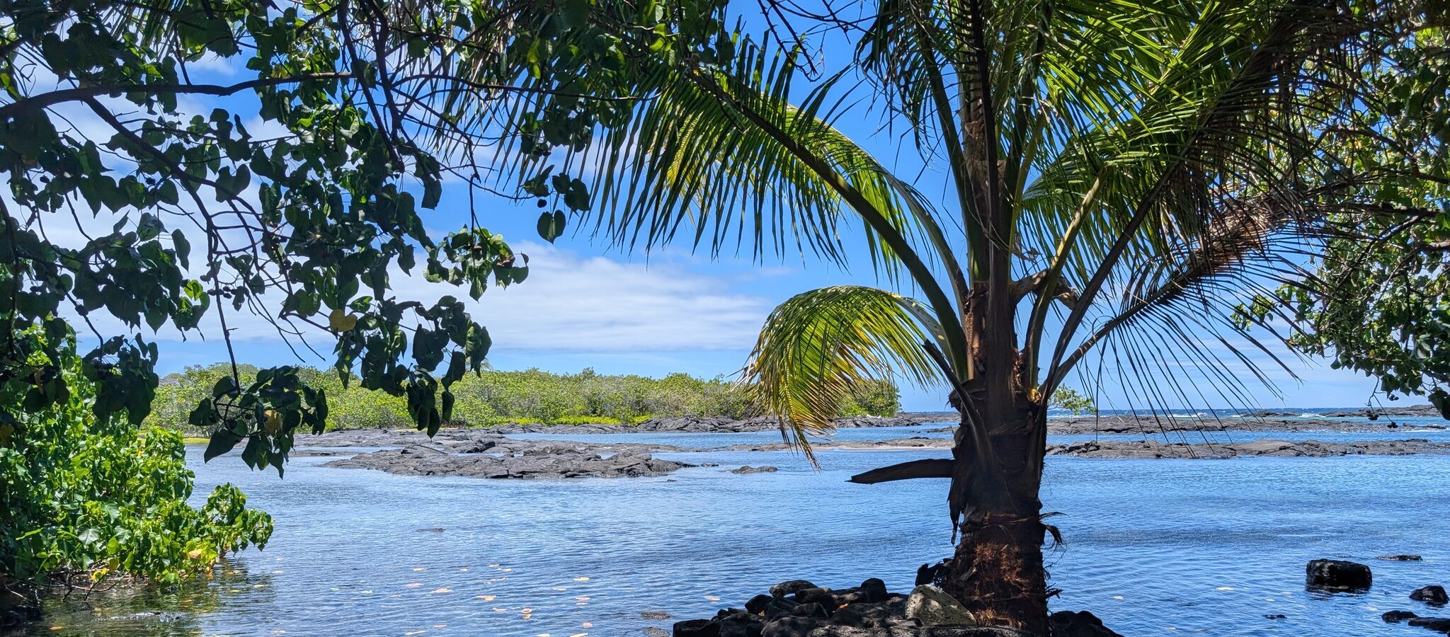
The bay was spectacular!
The rocky surroundings kept it well protected from the strong surf. It was windy and I was watching waves break against the rocks in the distance sending waves 20 feet or so high! But in the actual protected bay of Keauhou the water was clam and smooth – and full of fish.
It was refreshing after a lengthy hike in heat to take a dip. Then I relaxed in camp, set up my tent, and spent the day journaling and enjoying the environment.
The campsite was well-maintained and clean. Soft black sand underfoot, lava rocks used to line obvious trails between tent sites, makeshift benches and tables in genuinely useful locations. There were even some old boating ropes hung in the trees as improvised hammocks, making it even easier to find a way to relax.
Though I never did muster the courage to try out the surfboard left behind.


I had the entire bay to myself. I didn’t see another human until I made it back to my car the next day, when a Japanese tour group arrived at the same time – surprised to see a man walking randomly out of a lava flow that looked like it went to the middle of nowhere.
But I did share the beach with a monk seal and her pup. I kept my distance (as advised by the rangers when I checked in the day before) and just shot some photos and videos of them swimming in the surf.

The Ascent
Given I’d left my car at the trailhead, the only way out was back up the way I’d originally come down. I started early – the lower trail sections were the easiest and I felt comfortably making it through the low grassland by headlamp. I did stop at the first trail junction (~2 miles from camp) for breakfast to wait for the dawn, though.
There are plenty of extremely deep cracks and crevices in the lava as you climb the pali. Even though the trail itself was straightforward, the risk of stumbling into one of those in the dark was too high so I wanted more light to avoid serious injury.
I also forced myself to take a more gradual pace. Sipping water along the way with forced stops for hydration, electrolytes, and food every hour. This meant my ascent took somewhat longer than the previous day’s descent … but also meant I felt more whole when I reached the trailhead.
No lengthy nap needed to recover after this hike. It was another 3 hours of driving to get back to my family from here.
I took a last photo of a beautiful ‘Ohi’a lehua blossom on the lava near where I’d parked, downed some more Gatorade, and hit the road back home.

By the Numbers
My Garmin tracked the entire trip as 7.2 miles each way, from trailhead to campsite, descending (then re-ascending) 2,907 feet each time. I’d tried to over-prepare for a dry campsite by carrying 8 liters of water (more than the 3L/day recommended amount) and it wasn’t enough. I consumed all of that and an extra 3L filtered from the rain catchment tank at the Keauhou shelter.
If the tank had been dry, I would’ve been in a world of trouble.2When you check in at the backcountry office they’ll give you the status of each of the catchment tanks in the area. I knew going in that this tank was 3/4 full so there would be water if I needed it. I just didn’t expect to need it …
The descent to the shelter too me just over four and a half hours. The ascent from the campsite took me just over five and a half. It was only 15 minutes from the shelter to camp, so the longer ascent was due to my forced rest breaks.
The trail was pretty overgrown in some sections – lots of grass and shrubs. I wore pants, so my legs were ok. But the grass also hides obstacles like loose rocks so I did roll my ankle a couple of times. If you’re doing the trail, go prepared and exercise caution in the overgrown sections.
Much of the trail is marked only by rock cairns. They’re easy enough to see on the lava flows … but some are shorter than the grass tall when you cross the Ka‘ū Desert Wilderness. Be sure to take a good map and a GPS of some sort – just downloading the AllTrails map to a smartphone will help save you from deviating from the trail.3If you do hike with a smart phone be sure to bring a way to charge it. I hike with a solar-capable batter bank that kept my Pixel fully charged over my two-night trip.
The Uncomfortables
While this trip was pretty awesome, there are definitely some things that were less than ideal about the trip. Keep these in mind but don’t let them dissuade you from going.
Bathrooms
There are no restrooms at the trailhead and the only facilities at the campsite is a composting toilet near the three-walled shelter. Remember, it’s a 15-minute walk from the campsite through the woods over uneven/rocky ground. In the middle of the night it takes longer … And you’ll need to carry in your own TP and sanitizer. The toilet is clean, but if you’re not accustomed to backcountry facilities it’ll take some getting used to.

Monk Seals
The seals were gorgeous. They’re threatened – only about 1400 individuals remain in the wild – so seeing even one is amazing. Seeing an adult with a pup in the wild was an even rarer treat!
But as beautiful as the seals were … they were loud. Mama kept roaring every 30-60 minutes all night long. Sleep was hard to come by with her lounging on the beach just a few hundred feet away.
Bugs
During the day the bugs weren’t that bad. A few flies. A mosquito or two. I didn’t even need bug repellent.
After dark is a different story. I left part of my tent unzipped by mistake and earned some late-night visitors as a result. Waking up at 11 at night because a pair of cockroaches are dancing on your forehead is a surefire way to chase away any sleep you’ve managed to earn after a long hike.
Tsunami Danger
In 1975, a major earthquake of the Puna coast triggered an ~11 foot subsiding of the coastline and a massive tsunami. It caused millions in damage, dozens of injuries, and claimed the lives of two – including a Scoutmaster who’d been camping with his Scouts just a few miles down the coast from Keauhou.
The earthquake was major enough that you couldn’t stand. And it preceded the tsunami by a mere 84 seconds. That’s not a whole lot of time to grab anything and get to high ground. So having a plan should the unthinkable happen is critical.
The rangers reminded me about the tsunami hazards and to “seek high ground” if I felt any shaking. I asked whether or not the Keauhou shelter was high enough and was told, emphatically, it was not. Remember – the shelter itself was a 15 minute walk from camp … so at night, in the dark, in a panic … you’d still have to go further uphill to escape the danger. Meaning, as one ranger joked after I came back to criticize the advice, the best plan is more akin to “find a strong tree, get behind it, hold on, and pray.”4This is not my actual advice to you. But given my own abilities, knowledge of the trail, and fear of dying horribly in a tsunami … is probably the best I could do in such a situation myself.
In Review
Despite minor discomforts and the generally strenuous hike, this trip was totally worth it. After making the descent you’re rewarded with a picturesque, entirely private,5If you’re lucky. They only sell 12 permits per day for Keauhou and for this trip they sold three (including mine). The other two hikers bailed on their trip so I had the entire area to myself. slice of Hawaiian paradise. There’s plentiful guava on the trail, coconuts in camp, and fish in the bay.
I would absolutely visit Keauhou again. Just perhaps not via the same trail.
The Puna Kau Trail starts near the end of the Trail of Craters Road and follows the coastline past ‘Apua Point, Keauhou, and all the way to Halapē. There are campsites at all three locations and three-walled shelters (with water catchment tanks) at the farthest two. The entire trail (18.5 miles round trip) only covers ~800 feet of elevation change.
It’s a longer trip, but far flatter. You can also make it a multi-day journey and hit different stops along the way.
Most visitors to the Hawai’i Volcanoes National Park just see the main caldera or maybe the Thurston Lava Tube or Kilauea Iki crater. The backcountry is massive and gives you far more opportunity to explore and connect with nature. The cost of entry is your willingness to put up with minor discomfort along the way.
The payoff, though, is massive.
- 1It was a bit too technical for them, especially given the remote nature of the campsite and limited water availability. Definitely the next hike, though. ↩︎
- 2When you check in at the backcountry office they’ll give you the status of each of the catchment tanks in the area. I knew going in that this tank was 3/4 full so there would be water if I needed it. I just didn’t expect to need it … ↩︎
- 3If you do hike with a smart phone be sure to bring a way to charge it. I hike with a solar-capable batter bank that kept my Pixel fully charged over my two-night trip. ↩︎
- 4This is not my actual advice to you. But given my own abilities, knowledge of the trail, and fear of dying horribly in a tsunami … is probably the best I could do in such a situation myself. ↩︎
- 5If you’re lucky. They only sell 12 permits per day for Keauhou and for this trip they sold three (including mine). The other two hikers bailed on their trip so I had the entire area to myself. ↩︎

